Hiking in the Yukon
Posted
Last updated
I recently took a trip to the Yukon (and two days in Alaska) with my partner Elaine. The trip was mostly hiking focused and generally enjoying the nature. We took almost two weeks which was a good amount of time for us. Enough to not rush and soak in a lot of nature but not so long that our legs really started hurting and we started missing the comforts of a big city.
We did the “golden circle” route, starting in Whitehorse, driving south to Skagway Alaska, taking the ferry to Haines Alaska, then coming back into Canada via Haines road to Haines Junction then driving back to Whitehorse to close the loop.
We went in September which was a really nice time. The weather was a bit colder, usually around 15°C during the day and 5°C at night (with some variance). The colder weather means that the bugs were very mild. But the main reason that we liked this time of year is that the leaves were well into changing colour. This gave a beautiful mix of yellow and green on the mountains.
In this post I’m just going to quickly go over where we stopped and things we did. Basically some tips for if you want to go to the same area yourself.
Whitehorse
We landed in Whitehorse and I loved it. It was a small city (~30k people) but had a nice variety of food and stores and a nice downtown area.
Yukon Brewing
There were a small handful of local breweries in the Yukon and Alaska, but Yukon Brewing was by far the best one that we tried. We did a flight in their brewery and ended up buying a bunch of take-home that lasted us the whole trip. That turned out to be a great choice as the other breweries that we tried didn’t compare. The Yukon Gold old English ale really stood out as an excellent beer. If they sold in Ontario we would be regular customers.
They are also co-located (or the same as, it isn’t really clear) with Two Brewers Whisky, so we tried their release no. 44 and also ended up taking a bottle of that home.
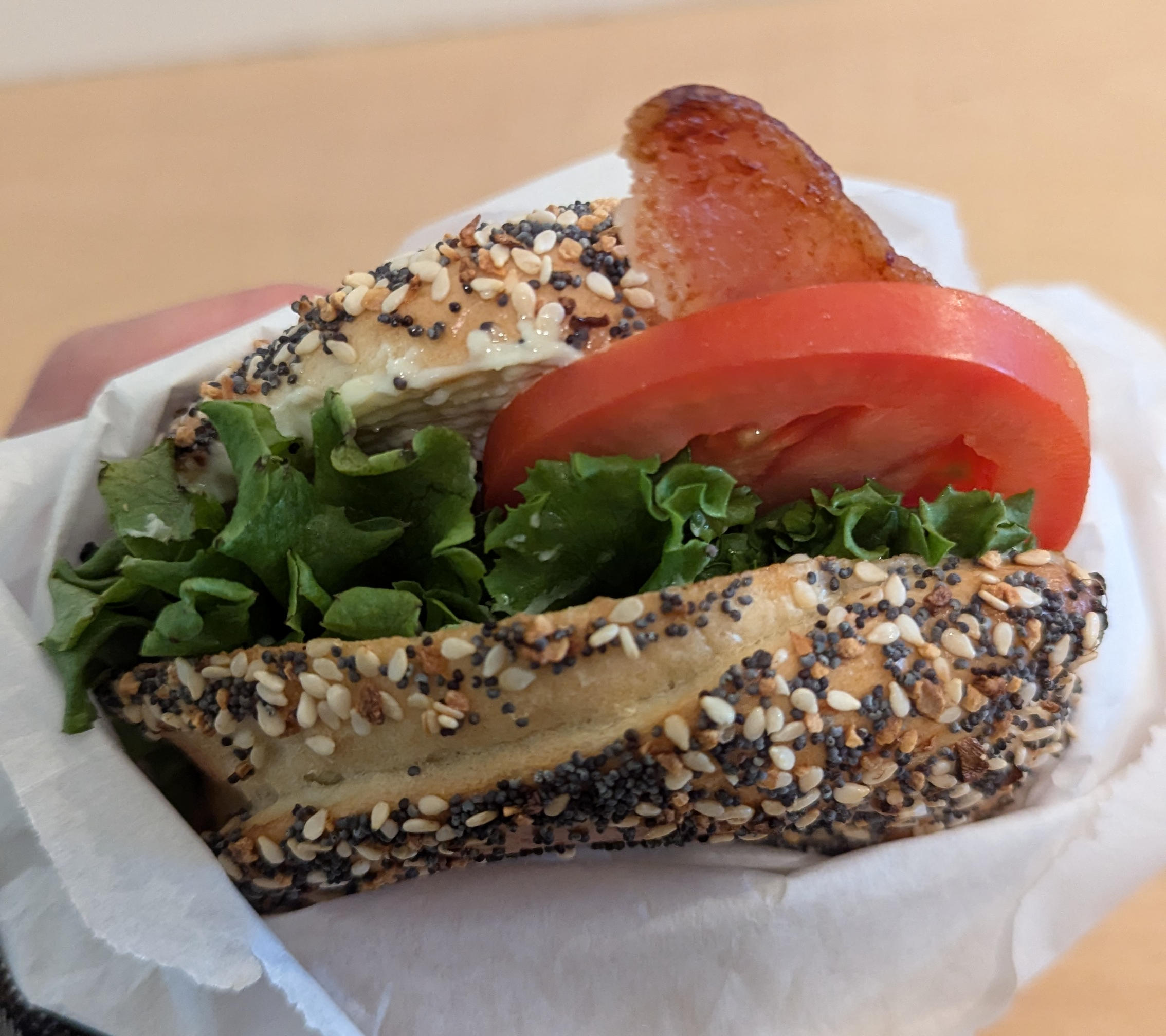
Bullet Hole Bagels
We also went to Bullet Hole Bagels for breakfast and loved their everything bagel, great with both BLT or smoked salmon. An easy recommendation.
Mountain Hero (Sam McGee) Trail
OpenStreetMap Yukon Hiking GPS Trace
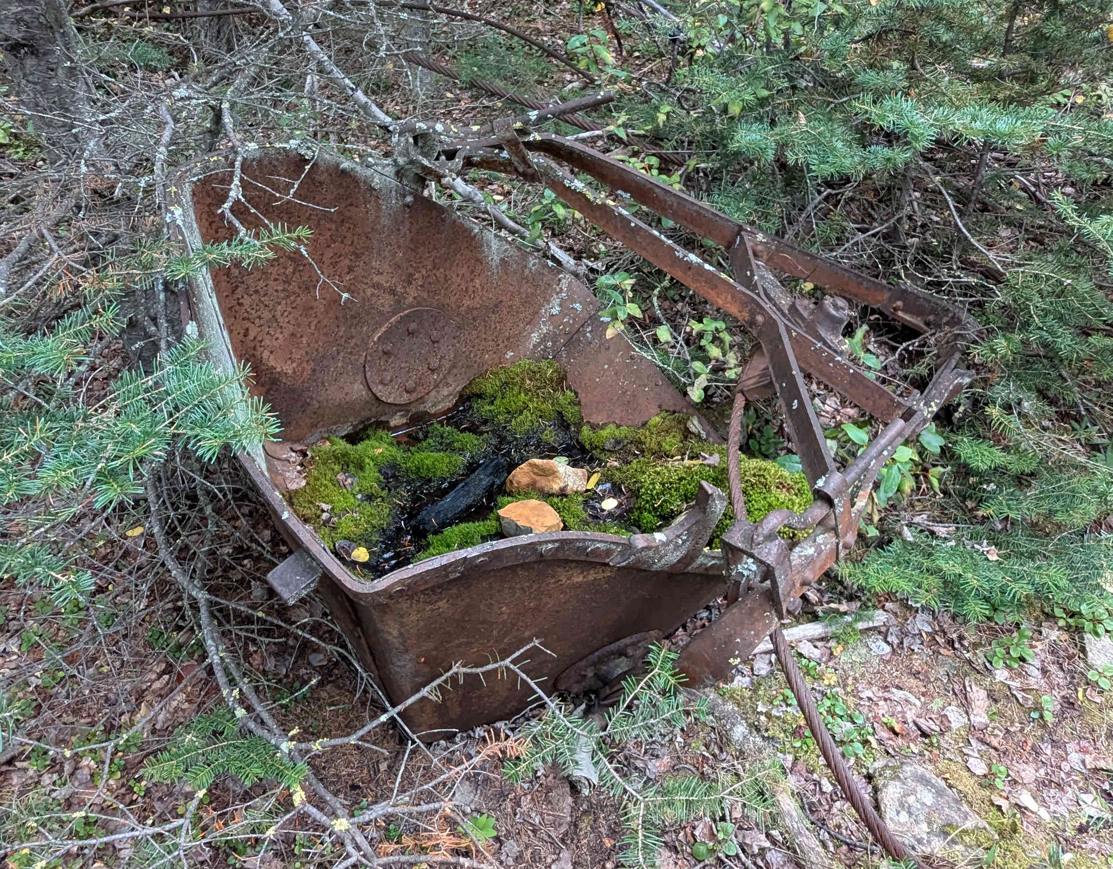
Our first real hike was the Mountain Hero trail (previously known as Sam McGee). This is 650 m up a mountain taking us almost 4 hours. The incline was pretty even so it was a relatively easy hike. It is labelled “moderate” on Yukon Hiking but there weren’t really any difficult sections. I think it is on the easy side as far as 650 m elevation hikes go.
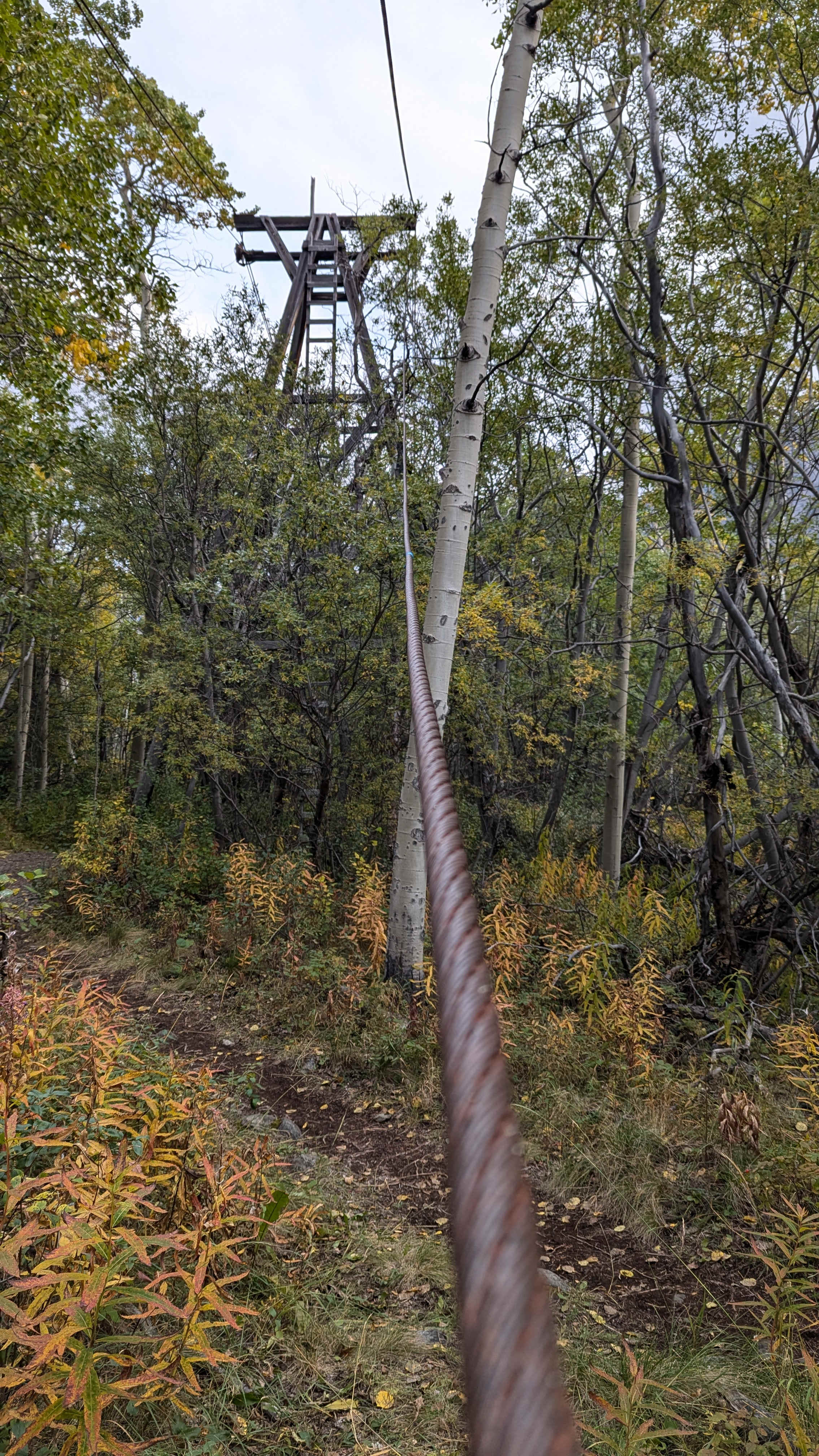
The unique point of this trail is that it repeatedly passes the decrepit “tramway” which was used to haul loads up and down the mountain when the silver mines were in operation. You can see wooden towers and large steel cables as well as the occasional rusty iron bucket along the trail.
While this trail doesn’t go to a peak there is still a great view at the top, and there are connecting trails should you like a longer hike that reaches the peak.
I would highly recommend this hike.
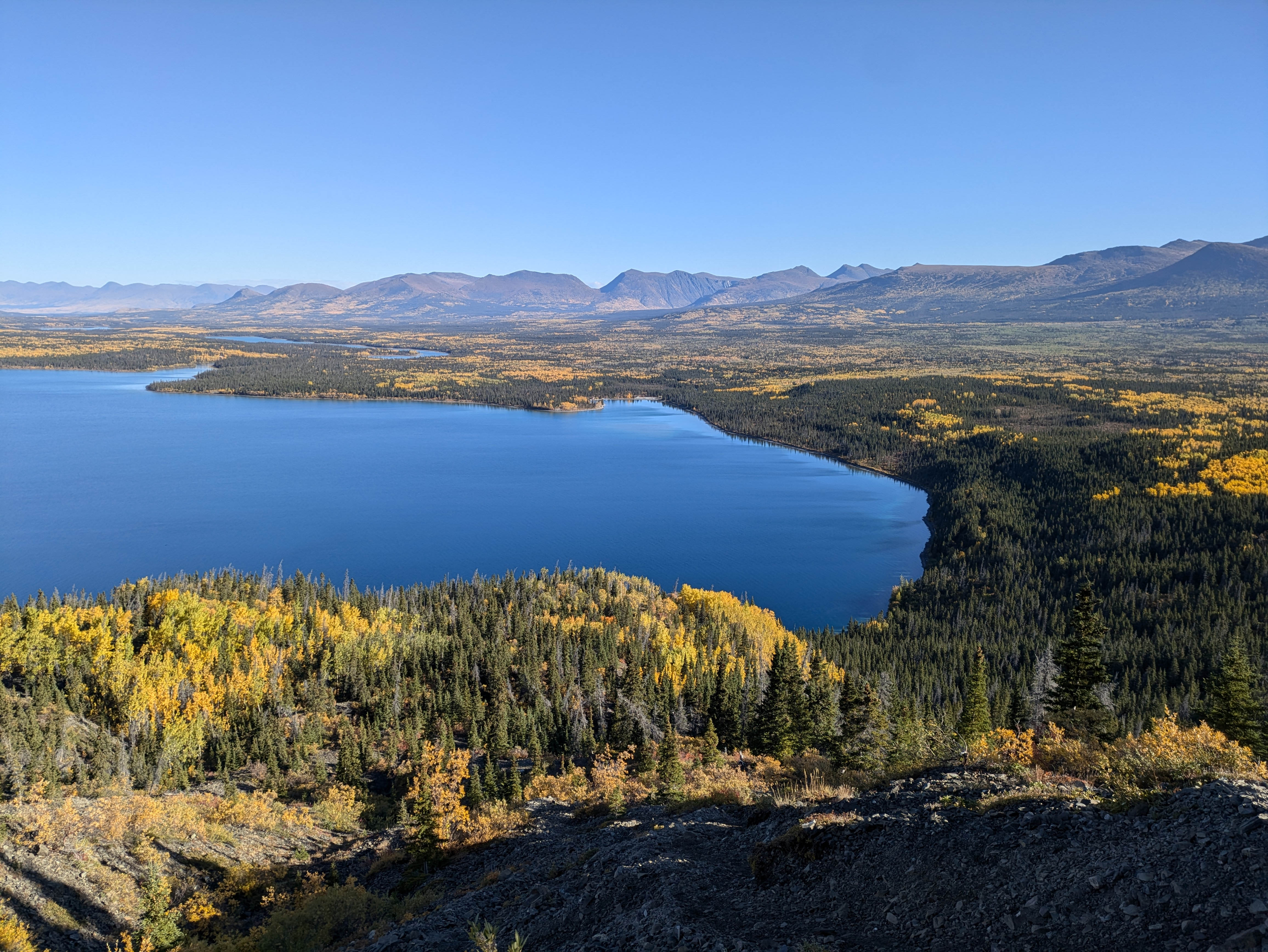
Caribou Mountain
OpenStreetMap Yukon Hiking GPS Trace
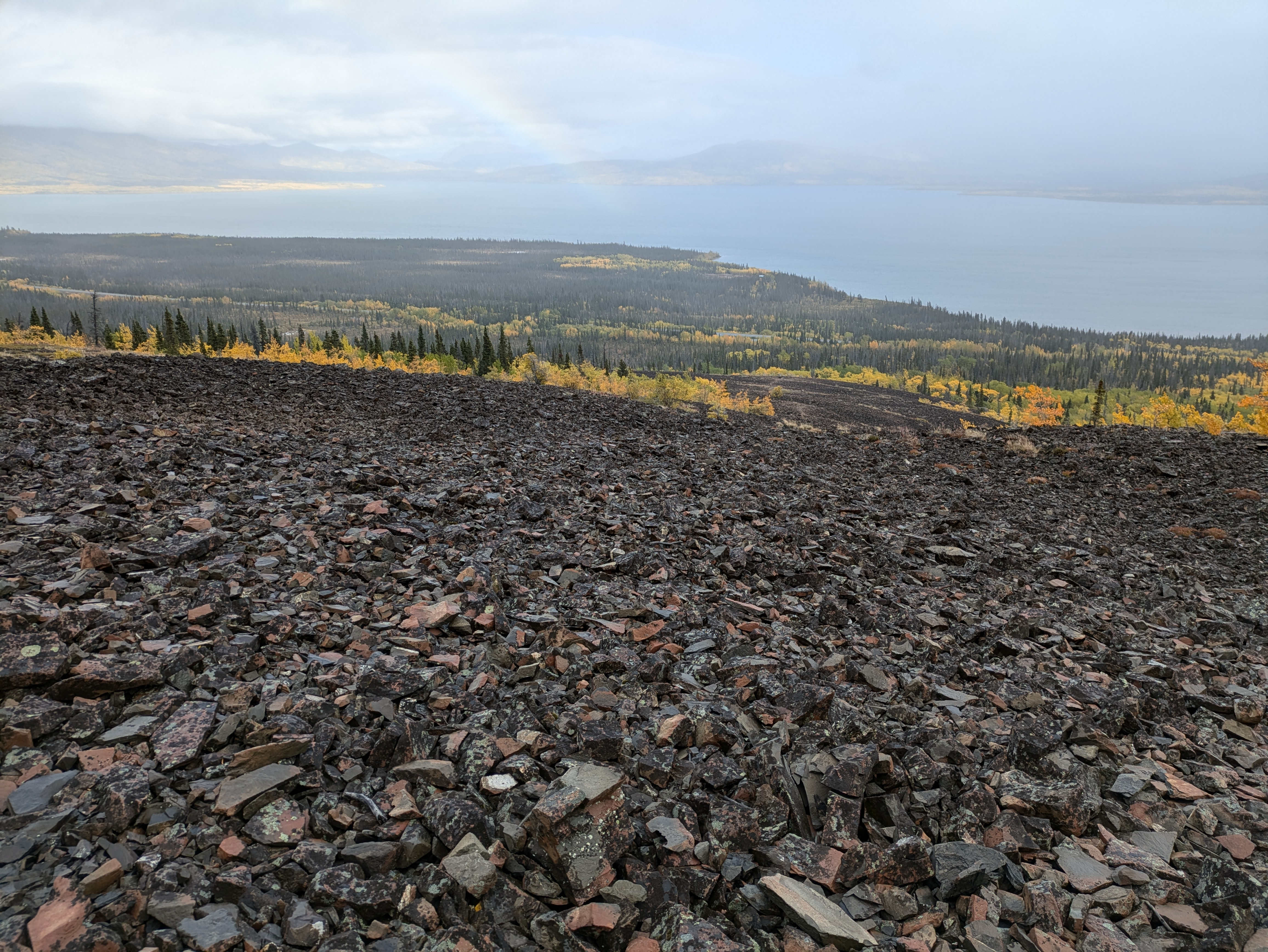
Our next hike was up Caribou Mountain. It took us almost 6 hours to hike the 1 km elevation gain that climbs the ridge and ends on top of a peak near Caribou Mountain. While not the highest peak in this area it is less inset, giving you an excellent view of Bennett Lake, Spirit Lake, Emerald Lake, Watson River as well as glimpses of Carcross and the Carcross Desert.
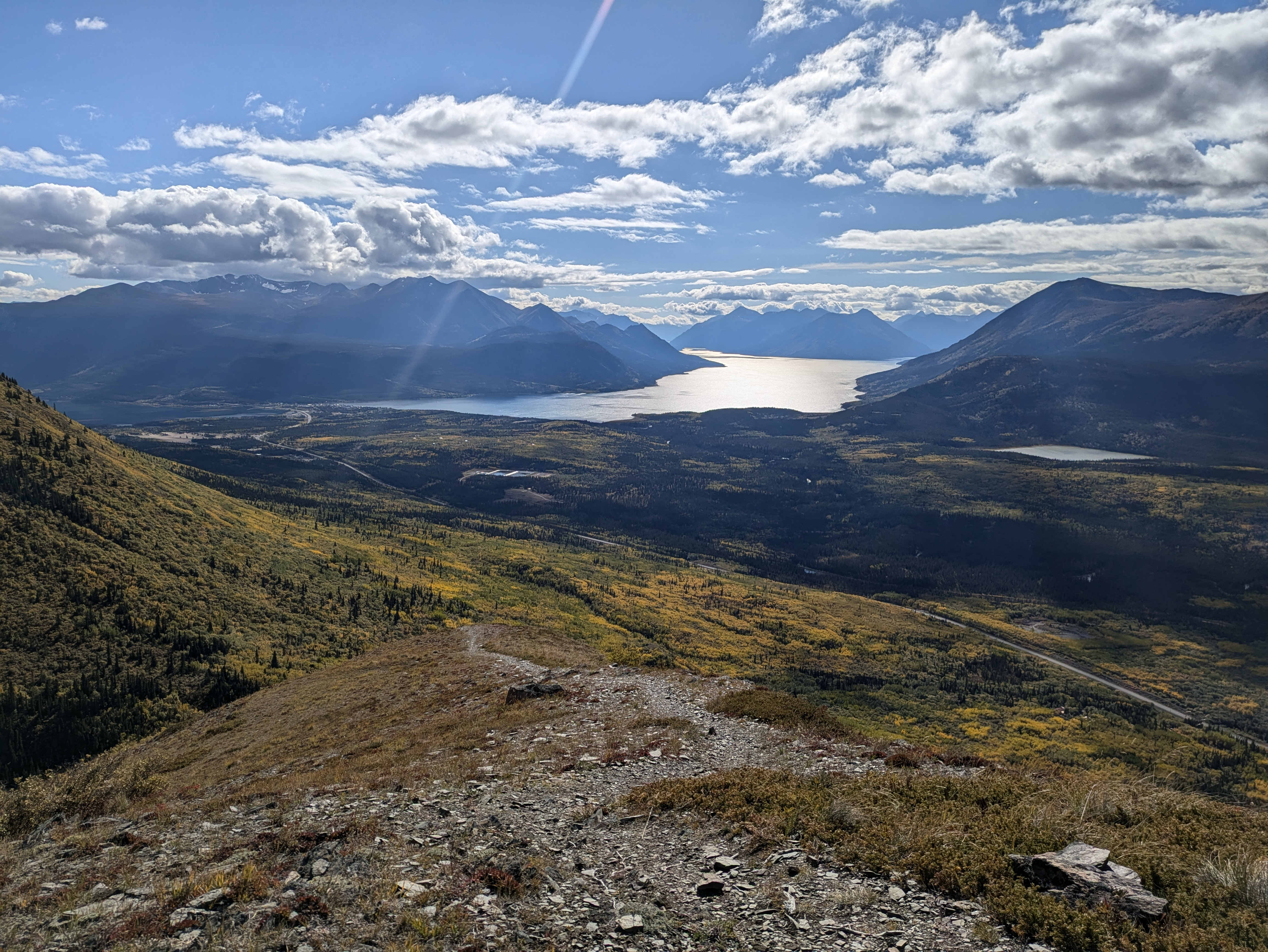
This hike was beautiful but much more difficult. Sections were steeper and looser. The trail gives great views for basically the whole way.
I would recommend this hike for people looking for a bit more of a challenge.
Skagway
Entering the US we get to Skagway which is a tourist trap that mostly serves as a day stop for cruise lines. It is themed as a bit of an old-time gold-rush town. It also has a sightseeing railway (which we decided not to go on, but it looked quite interesting). Personally I didn’t enjoy the town much and would recommend just skipping over. But Elaine, a lover of gimmicks, would strongly recommend spending a day here. So it is personal preference and the types of things that you enjoy.
Skagway is where you board the ferry to Haines. The ferry was very nice. It is a very comfortable ship (apparently quite new) and the views of mountains on either side of the inlet is very beautiful. Especially if you recently finished some hikes, it is a great change of pace to sit down and watch the mountains sail by.
Mount Ripinski
OpenStreetMap Yukon Hiking GPS Trace
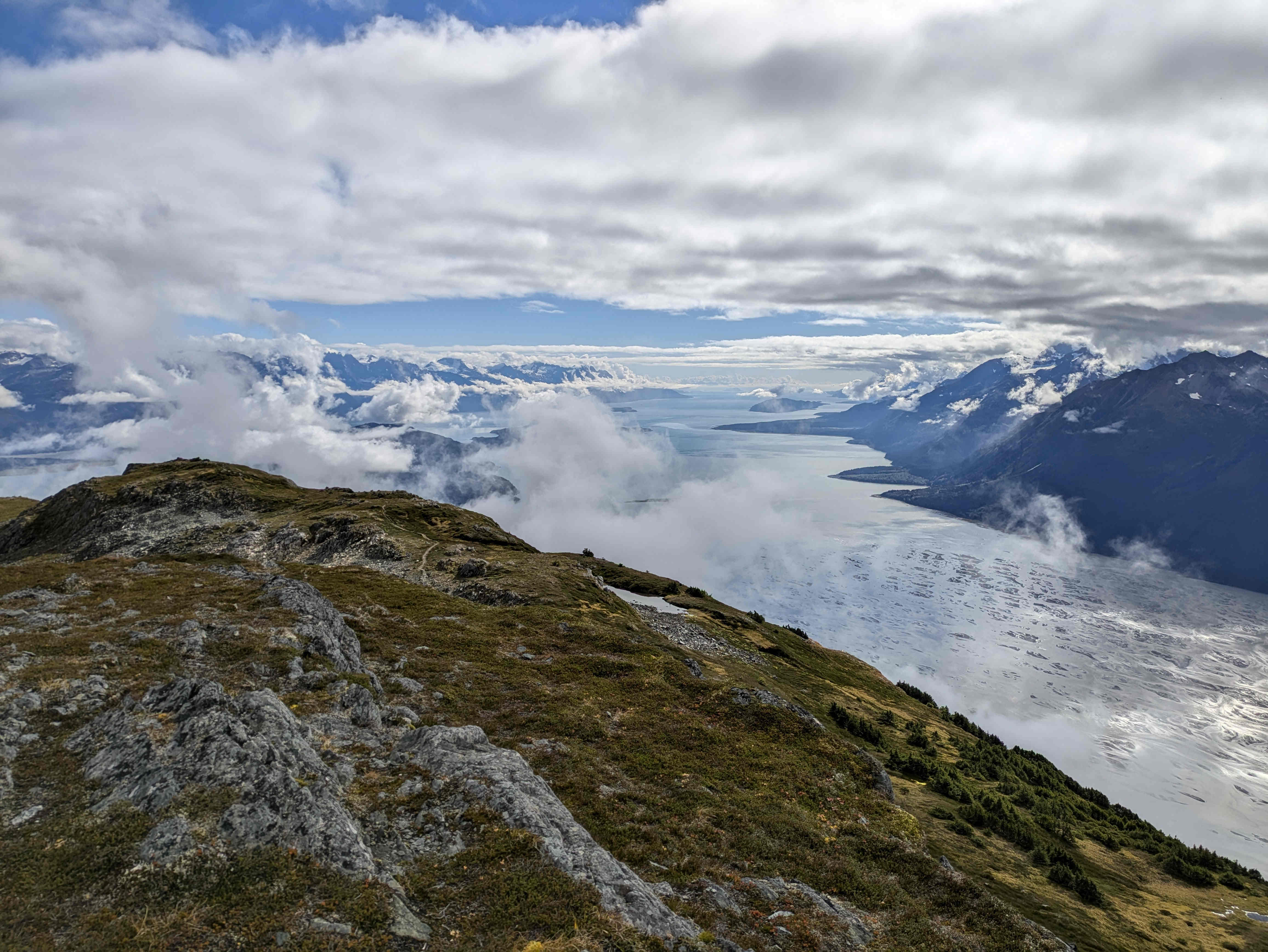
Our notable hike in the US was Mount Ripinski in Haines Alaska. Hiking up Mount Ripinski’s 1 km elevation took us over 7 hours. There were some steeper sections but nothing too difficult other than the elevation gain itself. Similar to the Mountain Hero trail, but twice as much.
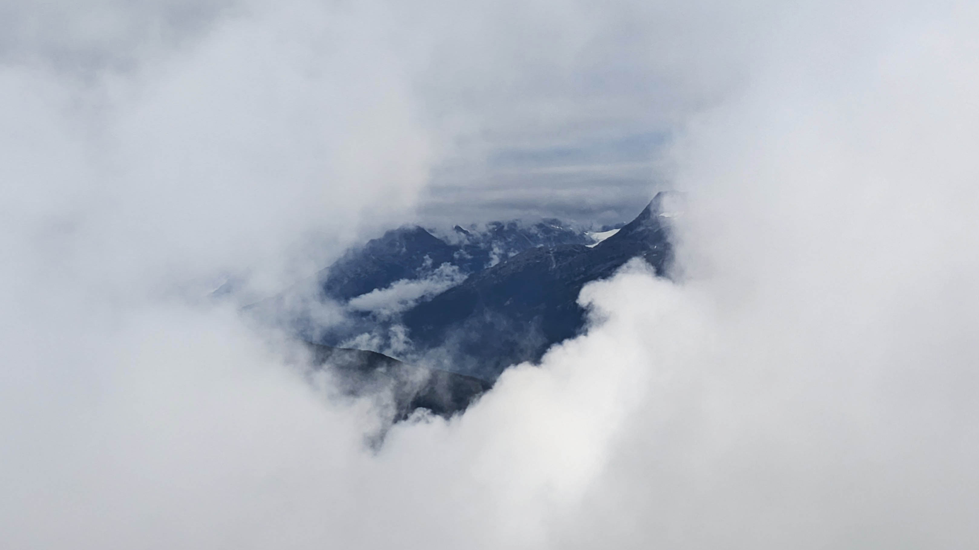
This was an interesting hike for us because we started in a fairly thick fog. The forest had a spooky haze in the distance and once we got to the top we were in a little bubble of mountain surrounded by clouds. It felt quite surreal, like a video game not rendering distance areas. As we got to the top the clouds mostly cleared and we got a spectacular view of the surrounding water and mountains as well as a view of Haines.
On the way down we saw our first bear. (The first of three we would see that day, the only bears we would see on the whole trip. All on my birthday!) Luckily it was quite far away and not on the path down.
I would also recommend this hike if you think you can handle it!
Haines Junction
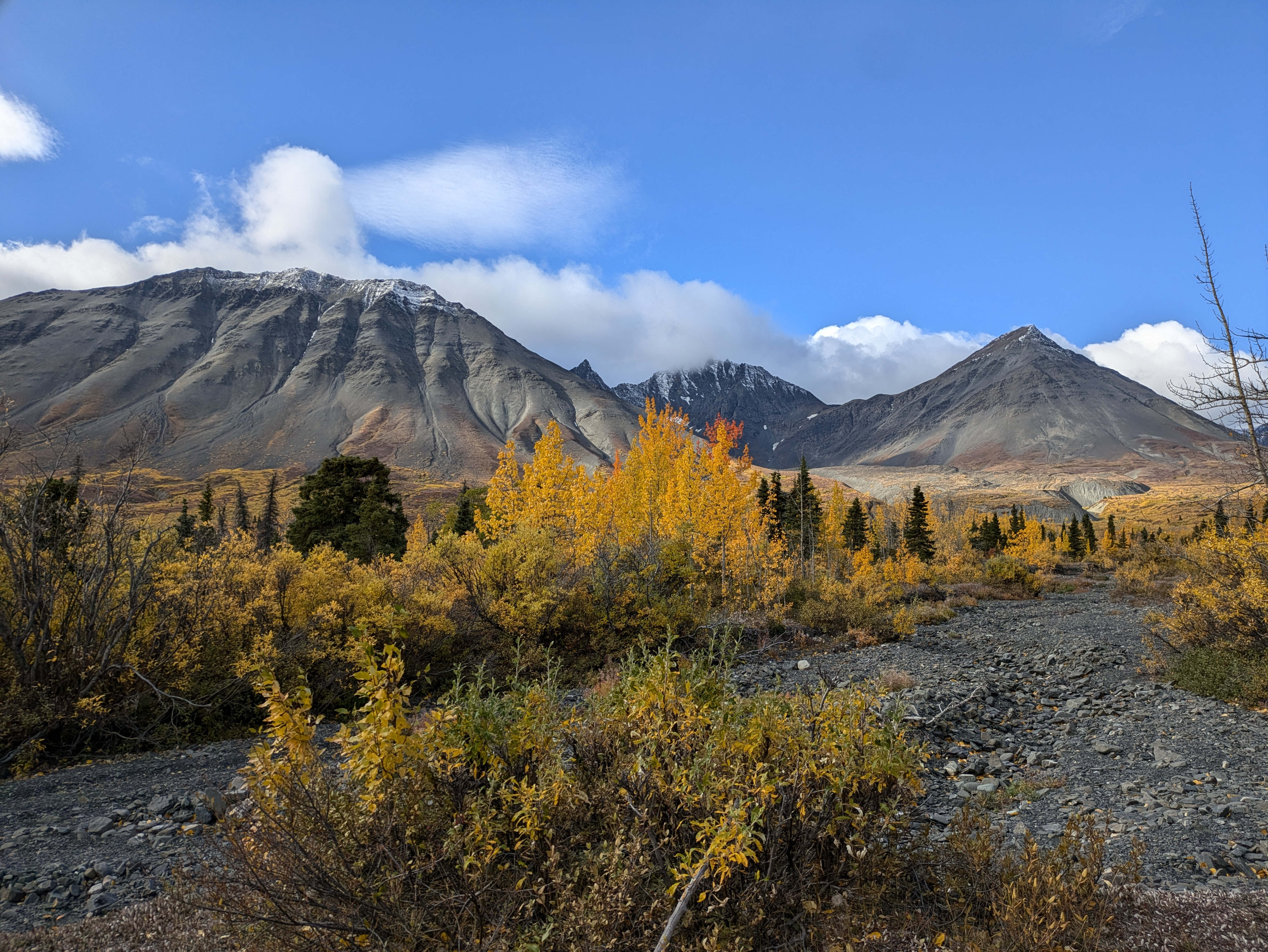
We are back in Canada at Kluane national park. This is a 22 000 km² reserve in the south-west corner of the Yukon. It also neighbours reserves in Alaska and British Columbia which together make up an almost 100 000 km² nature reserve which is a recognized UNESCO World Heritage Site. The reserve has nearly no roads in it, so your options are multi-day trips into the wilderness or just skirting the outside with day hikes. We decided to do the latter.
Haines Junction is tiny little town on the edge of the park with just 700 residents. It isn’t much but there are a few motels to stay in and amenities like grocery, gas and the convenience store. There is also a pretty nice Kluane National Park and Reserve Visitor Centre with some info about the park, wildlife and surrounding area.
Raven’s Rest Inn
We stayed in the Raven’s Rest Inn which we really enjoyed. It was pretty affordable, and we didn’t realize that we got some included perks because we were staying for 5 days. This included daily breakfast (which was very much appreciated) as well as free use of their “adventure gear” such as bear spray, canoes, kayaks, bikes and e-bikes. We didn’t end up taking advantage of this offer (although we very nearly borrowed some kayaks) but it was still nice to have the option to switch up our hikes for other ways of getting around.
Mile 1016 Pub
There are only three restaurants in Haines Junction and we tried them all. There is no way of putting this lightly, the food isn’t great. If you are looking for culinary genius you have picked the wrong town. Mile 1016 Pub was the best with a selection of good poutine, wings and some decent burgers. The other two where Chinese-American cuisine that were ok, but I wasn’t dying to go back.
There is also the Village Bakery which looks adorable (I love browsing their site, it feels very small-web) but unfortunately it closed a week before the start of our trip. Missing it is my biggest regret of the trip.
Rock Glacier
Parks Canada OpenStreetMap Yukon Hiking GPS Trace
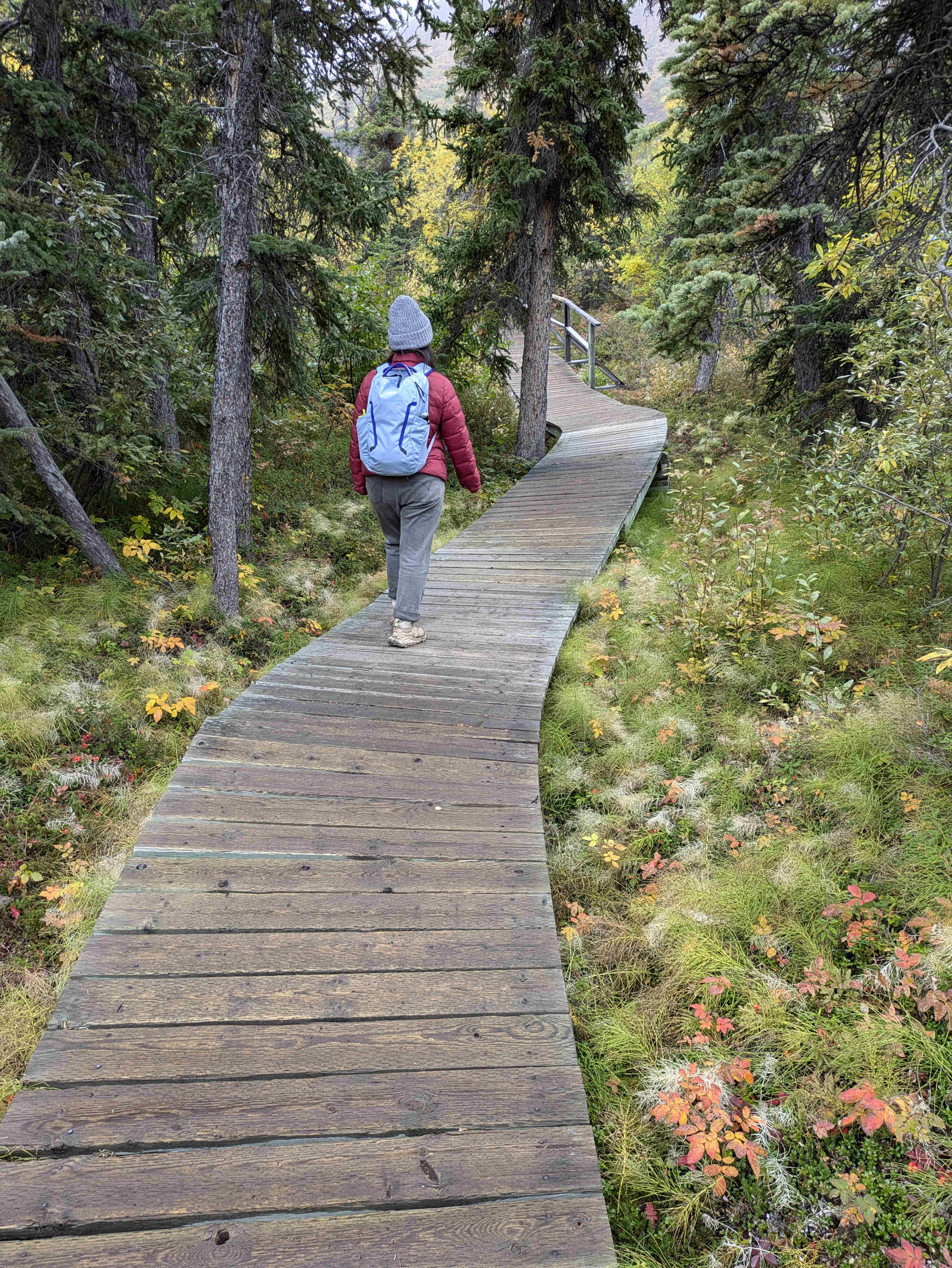
The first hike we did was the Rock Glacier trail. This was an easy 1 hour stroll with only 150 m of elevation. The only treachery was Parks Canada’s incredibly wavy boardwalks which got a bit slippery in the rain.
The trail gives a view of a “rock glacier” which is a pile of rocks that was pushed around by glaciers. The terrain was interesting and you could also see the surrounding lakes and mountains. Unfortunately we didn’t see any pikas but the hike was still quite nice.
I would recommend this hike for a quick and easy stroll.
Auriol Trail
Parks Canada OpenStreetMap Yukon Hiking GPS Trace
We took another gentle hike with the Auriol Trail. It does have a 450 m elevation gain but spread over 16 km it is very easy throughout. It took us 4½ hours to complete the loop.
We also used the parking lot of this trail as a good spot to watch the northern lights as it serves as a bit of a clearing (more on that later). After visiting a few times it felt only right to actually do the hike.
I would say that there is nothing particularly special about this trail. But everything in the Yukon is beautiful this time of year. We were surrounded by mountains, trees and bushes as well as passing a handful of rivers. This trail is also a loop, so you get a bit more variety than just there and back.
I would recommend this trail.
King’s Throne
Parks Canada OpenStreetMap Yukon Hiking GPS Trace
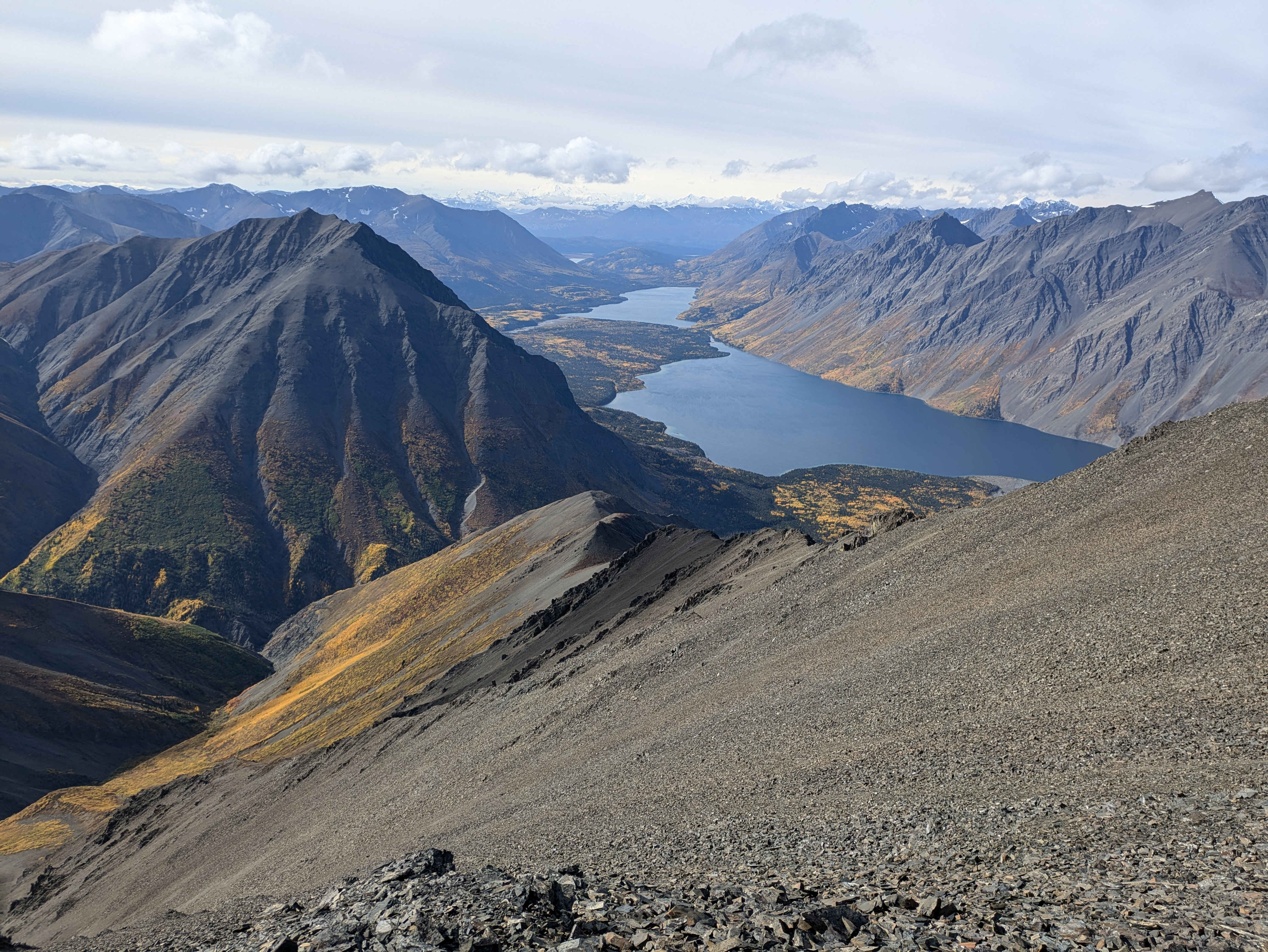
This was the challenge of our trip climbing 1300 m up and taking us over 8 hours. The lower part of this hike is considered a “trail” by parks Canada and is marked and maintained. The summit path is a “route” which is not maintained at all. Basically just an acknowledgement by Parks Canada that it exists and that some people go there. Overall the path was very clear, but the path to the summit was steep, loose and overall moderately treacherous. I would consider this trail “difficult”. It requires a bit more than perseverance to get through and if you aren’t careful you could definitely fall and slip quite far. But I wouldn’t go so far as to call it “extreme” as the risk of serious injury was fairly low as long as you were exercising common sense.
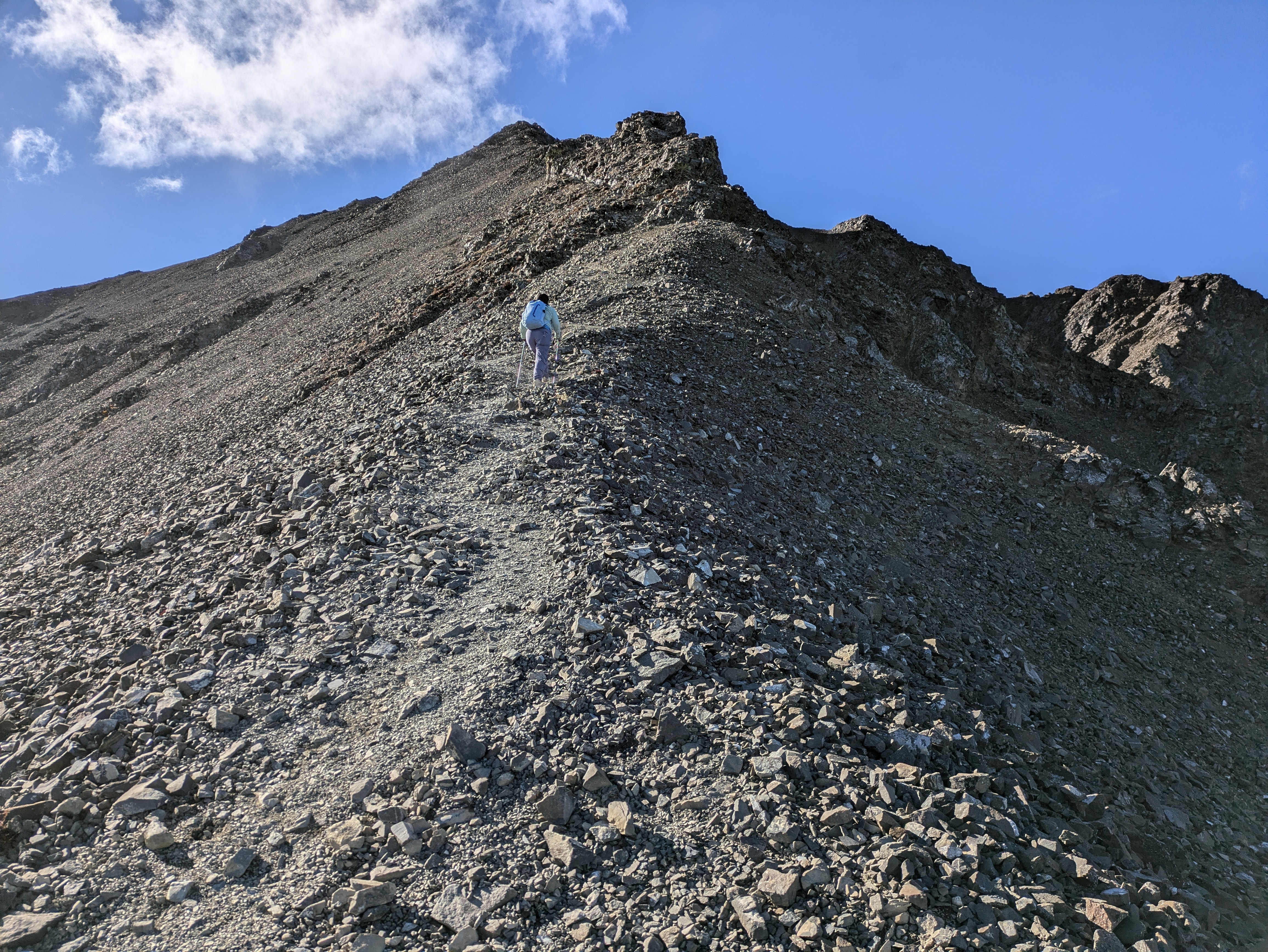
I loved this hike though. The full way you climb you get spectacular views of the areas around. Kathleen Lake is right in front of the “seat” of the throne and is beautiful and shimmering as you go up. Near the end of the trail it flattens out considerably, and you get to walk along a long ridge around the throne and gaze in all directions, including deeper into the park where you can see a long valley with Louise and Sockeye lake as well as taller snow-capped mountains in the far distance.
It is very difficult, but I would strongly recommend this hike.
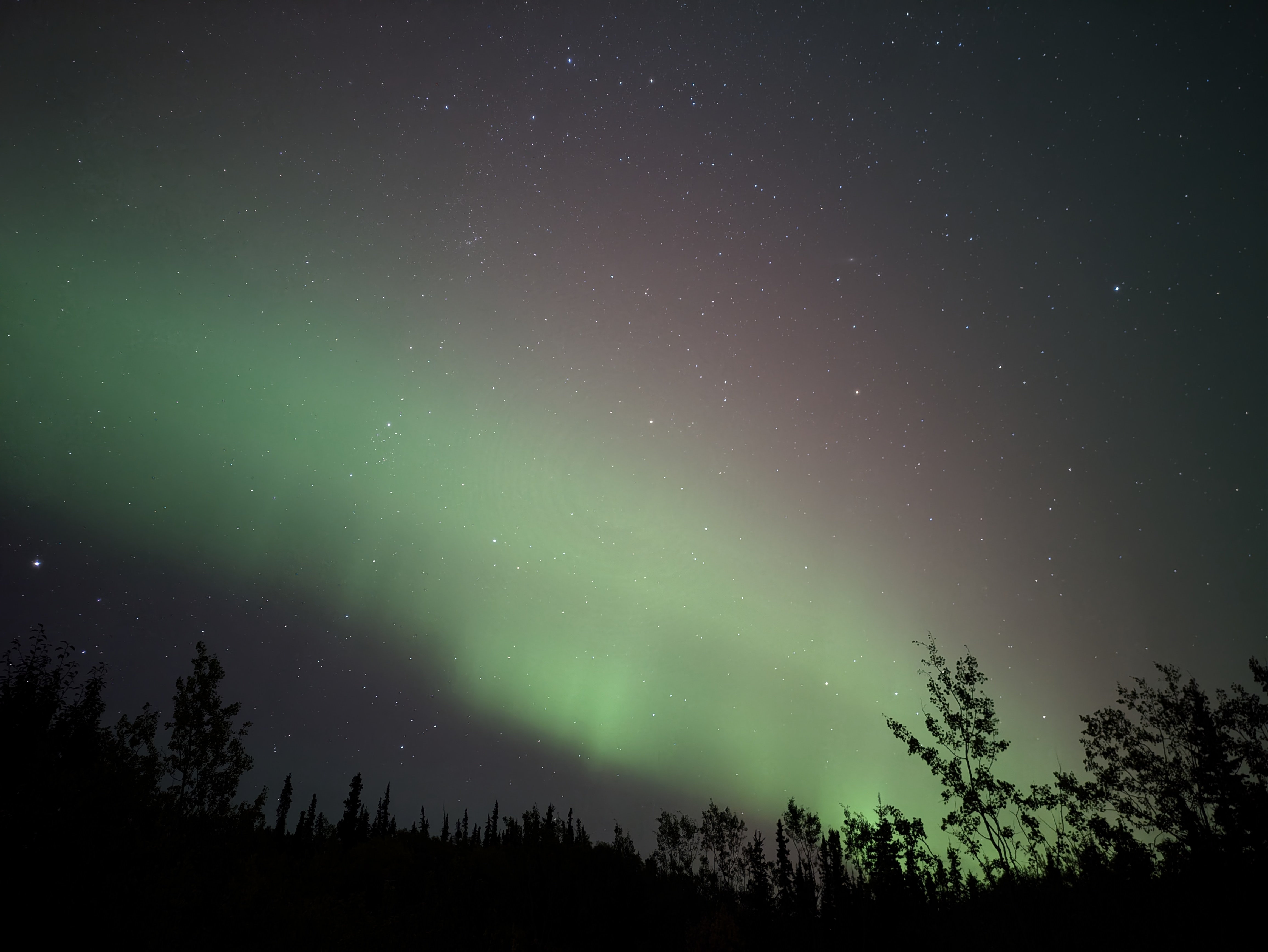
The Lights
Throughout the trip we were keeping our eyes out for the Northern Lights. We ended up seeing some beautiful lights a few times.
While we did have a new moon near the start of our trip the magnetic activity ended up aligning better with a full moon. This did brighten the sky and mute the lights a bit. But on the other hand it gives a nice blue background to our photos.
The key was definitely perseverance. We found a clear spot and stared at the sky most nights on our trip. Only skipping when it was very overcast. Overall the best resource for predicting activity was NOAA’s Aurora Dashboard and specifically this little text file which seems to be the primary source of data for every other site we looked at. University of Alaska Fairbanks’s Aurora Forecast is also quite nice. It is just pulling data from that text file but they launched a redesign halfway through our trip which provides a nice interface (notably it will do the timezone math for you).
Environment Canada’s Clouds Forecast For Astronomical Purposes purports to estimate where clouds will be. It does appear to be reasonably accurate, but the interface is miserable and you can basically estimate yourself by looking outside. Overall I didn’t find it that critical to our success.
For taking the photos I just used Google Camera. It has a hidden astrophotography mode. I can’t find any official documentation but it is a few steps to get working:
- There is an option in the “Advanced Settings” menu (3 settings menus deep) called “Enable time lapse for astrophotography”. Make sure it is enabled. (I think it is enabled by default.)
- Put your phone into “Night Sight” mode.
- Put your phone on a tripod (or prop it up on something, like a rock).
- After about a second the shutter button will switch from the Night Sight moon to astrophotography stars. Your phone needs to be very still, even touching the tripod may make it refuse to switch.
- Hit the shutter button and wait about 4 minutes. You will get a photo and a short time-lapse video.
You definitely aren’t going to get award-winning photos with a phone, but it does an impressive job automatically (most photo-contest winners are manually aligning individual frames) with the camera that you already have in your pocket (and a tripod).
Outro
I loved the trip. I have wanted to go to northern Canada for a long time and this definitely satisfied. While I was considering going further north (ice highways?) or doing a canoe trip, I think the decision to do more of a road trip was the right one. Doing a canoe trip from your house is nice because you can bring your equipment and pack your own meals, out in the Yukon we would have had to get everything from an outfitter. I’m sure it would have been fine and spending many days in the depths of Kluane would have been amazing but I don’t think we missed that much. You can get peace and quiet sitting in the middle of the highway this time of year 😆.
If I could change anything I would consider if we needed to travel to different cities. We stayed 5 days in Haines Junction exploring Kluane, and we could have easily spent another 5. Mix in some biking and paddling and it would have been a nice trip in its own right. However, I think it was better to move around a little (we would have quickly gotten tired of the 3 restaurants in town). The small amount of driving on our “road trip” gave us some nice variety.